
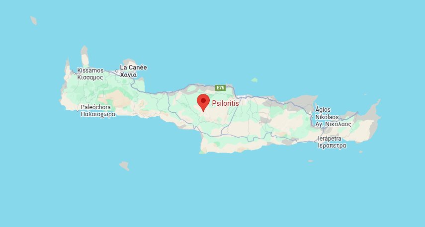
In the heart of Crete stands a majestic mountain that has captivated attention and fueled the imagination since ancient times: Mount Psiloritis.
At 2,456 meters elevation, this imposing massif is the highest point on the island, dominating the plains of Messara and Heraklion with its steep slopes.
Known to the Ancients as Mount Ida, this limestone giant witnessed the birth of myths and shaped Mediterranean landscapes over millions of years.
Designated as a UNESCO Global Geopark since 2015, Psiloritis combines remarkable geological heritage, unique biodiversity, and centuries-old pastoral traditions.
For hikers seeking authenticity, this sacred mountain offers much more than a simple athletic challenge: it's a dive into the geological history of the Mediterranean and the deep soul of Crete.
- Geography and geology of the massif
- Between myth and history
- A biodiversity sanctuary
- Hiking trails
- Cultural heritage and traditions
- Practical information
Mount Psiloritis: Geography and geology of the massif
Mount Psiloritis occupies a central position on the island of Crete, straddling the prefectures of Heraklion and Rethymno. Its summit, peaking at 2,456 meters, bears the name Timios Stavros (the Holy Cross) where a small white chapel stands, visible in clear weather from the north and south coasts of the island.
A fascinating geological history
The massif formed millions of years ago when the African tectonic plate began pushing under the European plate, forcing the relief to emerge from the sea. This titanic collision created the imposing limestone formations that characterize today's landscape. Rock outcrops reveal complex stratigraphy, with layers of limestone, folded marble, and even remnants of the ancient Tethys Ocean in the form of ophiolites.
The region displays spectacular karst phenomena: sinkholes, deep caves, narrow gorges, and abundant springs. These formations testify to millennia of water's work on limestone, creating a complex underground network that feeds numerous springs and makes Psiloritis a natural water tower for central Crete.
Contrasting terrain
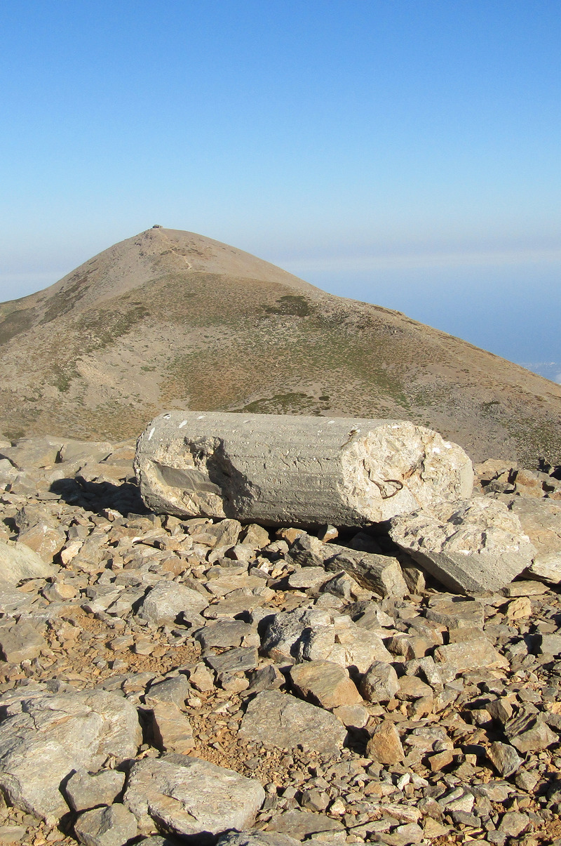
The massif consists of several summits exceeding 2,000 meters, including the peak of Agathias at 2,424 meters. The Nida Plateau, in the heart of the massif at an elevation of about 1,400 meters, is the preferred starting point for the ascent. This pastoral plateau offers a lunar landscape dotted with dry-stone constructions called mitata, ancient shepherds' shelters that testify to centuries of transhumance.
Mount Psiloritis between myth and history
The birthplace of Zeus
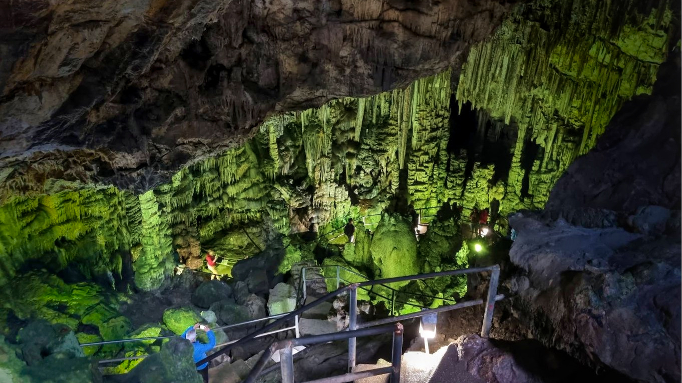
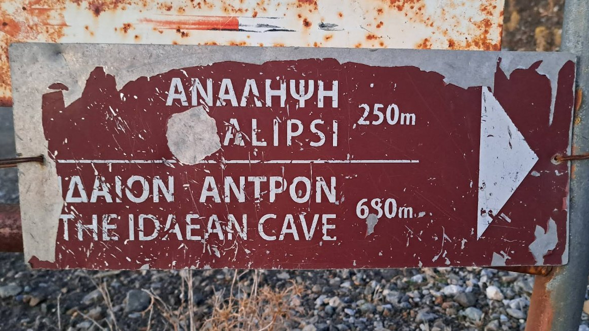
According to Greek mythology, it was in the Ideon Andron cave, located on the northern slope of Mount Psiloritis, that Zeus was born to Rhea. The goddess had taken refuge there to protect her child from Cronos, his father, who devoured his offspring to avoid being overthrown. Raised by the nymphs Ida and Adrastea, protected by the Curetes whose warrior dances covered his cries, and fed by the goat Amalthea, Zeus grew up in these mountains before overthrowing the Titans and becoming master of Olympus.
This mythical cave, accessible from the Nida Plateau, served as a sanctuary from the 11th to 9th century BCE. Archaeological excavations have revealed countless votive offerings, testifying to the religious importance of the site during antiquity.
A sacred mountain
For the Minoans, Psiloritis was already a sacred mountain, well before classical Greek myths became attached to it. The site of Zominthos, located in the massif's heights, reveals the remains of an important Minoan settlement. These archaeological discoveries confirm that the first Cretan civilizations maintained a deep spiritual connection with this majestic mountain.
A biodiversity sanctuary
A UNESCO Global Geopark
Recognized as a UNESCO Global Geopark in 2015, Psiloritis spans 1,272 square kilometers and represents one of the most remarkable territories in the eastern Mediterranean. This recognition values not only its geological richness but also its extraordinary biodiversity and intangible cultural heritage.
Endemic flora and botanical diversity of Psiloritis
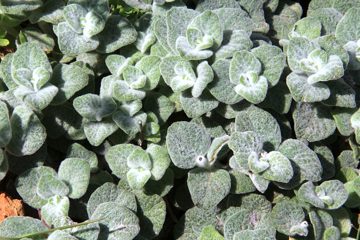
The massif hosts remarkable biodiversity with over 1,700 plant species, of which 10% are endemic. Among the massif's botanical treasures is the famous Cretan dittany, an aromatic plant used since antiquity for its medicinal properties. Notable endemic species include the Cretan zelkova, Cretan arum, Cretan cyclamen, and several rare orchids such as Cephalanthera cucullata.
On the Gious Kambos plateau, whose name means "Plain of Eos" in reference to the goddess of dawn, grows an endemic red tulip classified as a vulnerable species. Rocky gorges shelter fascinating cliff-dwelling species, while forests of cypress, kermes oak, and maple punctuate the slopes up to 1,400 meters elevation.
What wildlife can we encounter on Psiloritis?
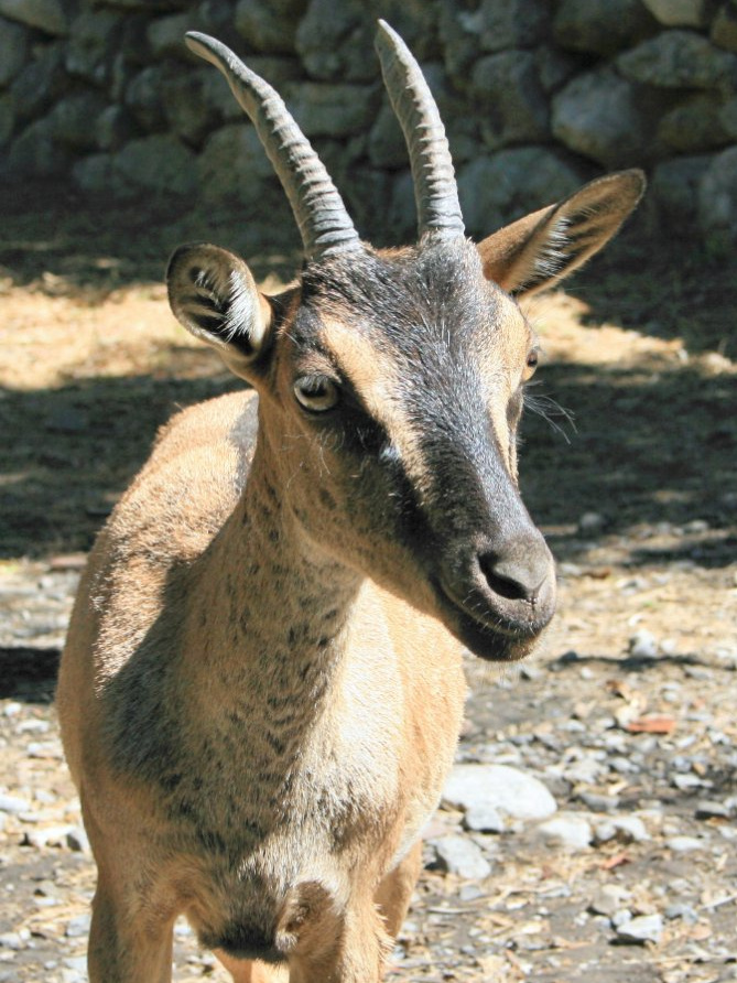
The massif provides refuge for remarkable fauna. The kri-kri, Crete's emblematic wild goat, can be observed here, along with numerous raptors including the lammergeier and griffon vulture. The Cretan wildcat, an endemic subspecies, discreetly roams the heights. Birdwatching enthusiasts can observe a wide variety of migratory and nesting birds, while the gorges and caves shelter several protected bat species.
Hiking trails
The classic ascent from Nida Plateau
Several paths provide access to the summit, the three most well-known being the E4-east from Nida Plateau, the E4-west from Fourfouras, and the southern route from Kamares. The most frequented route starts from Nida Plateau, accessible via a winding 22-kilometer road from the village of Anogia.
The ascent represents an elevation gain of approximately 950 meters for a total duration of three to four hours going up. The trail begins with a steep section then follows a ravine westward before reaching a first pass around 1,900 meters. After a slight descent, the path climbs toward Agathias peak before turning west for the final hour of walking to the summit.
From the summit, the view encompasses the entire island. To the north, the Aegean Sea sparkles and, in clear weather, you can even glimpse Santorini on the horizon. To the south, the Libyan Sea stretches to the island of Gavdos, Europe's southernmost point. The Messara plains unfold their fields and greenhouses, while the neighboring massifs of the White Mountains and Dikti trace Crete's mountainous silhouette.
Other discovery routes
Over 20 marked trails allow exploration of the massif's different facets. The gorges of Rouvas, Patsos, and Vorizia offer more accessible hikes in lush environments where perennial springs flow. The Rouvas forest, with its centuries-old cypresses and majestic plane trees, provides an ideal alternative for walkers wishing to discover the massif's plant richness without undertaking the complete ascent.
Cultural heritage and traditions
The mitata, pastoral architecture
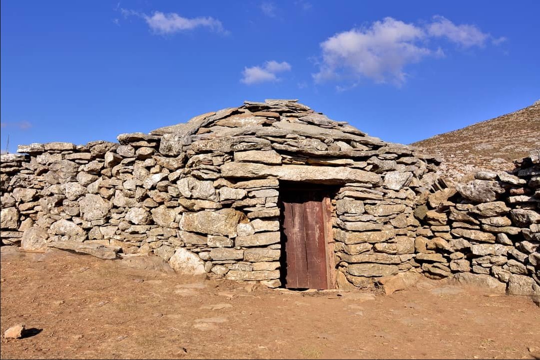
On Nida Plateau stand numerous mitata, circular dry-stone constructions topped with domes. These traditional shelters served shepherds during summer transhumance. They housed the men, served for milking sheep and goats, and hosted cheese-making operations. Some of these structures, abandoned around the mid-20th century, are now restored and testify to ancestral architectural know-how perfectly adapted to the mountain environment.
Characteristic villages
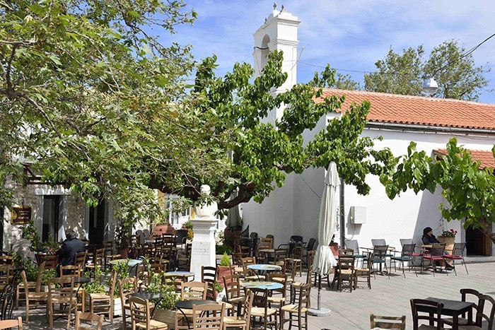
Anogia, the main mountain village north of the massif, embodies the rebellious soul of Crete. Known for fiercely resisting successive occupations, this active town perpetuates traditional crafts: weaving carpets and blankets with geometric patterns, wood carving, and making traditional musical instruments. Cretan music, with its characteristic lyra, still resonates during village festivals.
Other villages like Axos, famous for its pottery, or Margarites where ceramics are worked using millennial techniques, allow discovery of living craftsmanship. For those wishing to discover Cretan authenticity beyond the beaten path, our Crete itineraries integrate these cultural encounters.
Practical information for hiking Mount Psiloritis
What is the best time for ascending Mount Psiloritis?
The best period for the ascent extends from June to September, when weather conditions are most stable. High-altitude areas remain snow-covered until late June, and weather can change rapidly even in summer. In spring, the massif adorns itself with spectacular blooms, while autumn offers magnificent light, though the first snow episodes can occur as early as October. For a September trip to Greece, Psiloritis makes an ideal destination with pleasant temperatures and moderate crowds.
Mountain refuges and accommodation
The Timios Stavros mountain refuge (Prinos refuge), located at about 2,000 meters elevation, offers basic accommodation with around twenty places. This unguarded refuge has blankets but no bedding, and hikers must bring their sleeping bags. At Nida Plateau, the Lakkos tou Mygerou refuge serves as a starting point but doesn't offer accommodation. For superior comfort, it's preferable to stay in surrounding villages like Anogia where several guesthouses and rooms welcome hikers.
Trail marking and orientation
Psiloritis is crossed by the European E4 trail that traverses Crete from west to east. The E4 marking, with its characteristic yellow and black marks, guides hikers on main routes. From Nida Plateau, follow the cairns and E4 marking for the classic ascent. However, marking can be irregular in places, particularly in rocky summit areas. A detailed topographic map and GPS are strongly recommended, especially in fog which can quickly reduce visibility.
Mountain guide: recommendations
Ascending Psiloritis doesn't technically require a mountain guide for experienced hikers accustomed to high mountains. However, hiring a local guide is strongly recommended for several reasons: knowledge of changing weather conditions, expertise on the optimal route according to season, sharing information about the massif's geology and biodiversity, and increased safety in case of problems. For less experienced hikers, a guide becomes essential given the significant elevation gain and absence of water points.
What to bring in your backpack and on yourself?
The ascent requires classic hiking equipment: high-top hiking boots with studded soles, layered clothing including protection against wind and cold (even in hot weather below, the summit can be windy and cool), cap, sunglasses, and sunscreen. Plan for at least two liters of water per person and energy food. The rocky terrain and steep slopes make trekking poles valuable, particularly appreciated on the descent.
What is the difficulty of the Psiloritis ascent?
Although technically accessible to any hiker in good physical condition, the Psiloritis ascent should not be taken lightly. The significant elevation gain, altitude, sun exposure, and absence of water on the route make it a demanding hike. Starting at dawn is recommended to avoid extreme heat, and plan for five to six hours for the round trip from Nida Plateau. For families, more accessible alternative routes allow safe discovery of the massif.
How to reach Psiloritis?
From Heraklion or Rethymno, reach the village of Anogia then take the road to Nida Plateau (22 kilometers of winding mountain road). Parking is available at the Lakkos tou Mygerou refuge. For those who prefer discovering Crete without worrying about logistics, our guided trips include transportation and supervision by guides who know the massif perfectly.
Specific regulations for Psiloritis
As a UNESCO Geopark, Psiloritis deserves special respect. Don't pick plants, particularly protected endemic species. Stay on marked trails to limit erosion. Carry out all your waste. Basic refuges don't have proper sanitary facilities, so it's important to scrupulously respect the environment.
Mount Psiloritis embodies by itself the natural and cultural richness of Crete. Its landscapes sculpted by tectonic forces and erosion, its extraordinary UNESCO-recognized biodiversity, its deep connections with Greek mythology, and its living pastoral heritage make it a destination of choice for hikers seeking authenticity. The ascent of this roof of Crete certainly represents a physical challenge, but above all offers the opportunity to touch the very essence of this Mediterranean island: a territory where raw nature and millennial human imprint harmoniously combine.
Grand Angle, an adventure travel agency specializing in Greece, accompanies you in discovering these Cretan mountains through hiking and trekking trips in Crete designed to reveal all the island's beauty. Whether you prefer adventure with self-guided tours in Greece, a guided circuit in Greece with the reassuring supervision of a local guide, or even more athletic trekking, our teams work with you to create the trip that matches your expectations. To explore other equally fascinating Mediterranean destinations, browse our nature trips in Greece that combine landscape discovery and cultural immersion. Fans of island hiking will also appreciate our treks in the Cyclades or our trips to the Ionian islands. For those who prefer discovering Greece differently, our cycling trips in Greece offer a different perspective on these magnificent landscapes.
Share the article on

Written on 17/11/2025 by:
Robin Delattre